The Stavely Geoscience Project
Demonstrated prospectivity
World-class pre-competitive geoscience carried out over a number of years has shown western Victoria to be prospective for copper, other base metals and gold.
The geoscientific work carried out through the Stavely Geoscience Project was a collaboration involving Geoscience Australia, the Geological Survey of Victoria (GSV), the Deep Exploration Technology Cooperative Research Centre, and other partners between 2015 and 2018. The project produced a suite of pre-competitive geoscience data, a Regional Synthesis and a 3D geological model of the area.
Unpacking the science behind the Stavely Arc
Regional geology
The Stavely Arc is a geological zone in Victoria that runs from near Mildura to Mortlake in western Victoria. Geologists believe that 500 million years ago the region was on the border of a super-continent called Gondwana, giving it a similar geological environment at the time to the copper-rich Andes in South America.
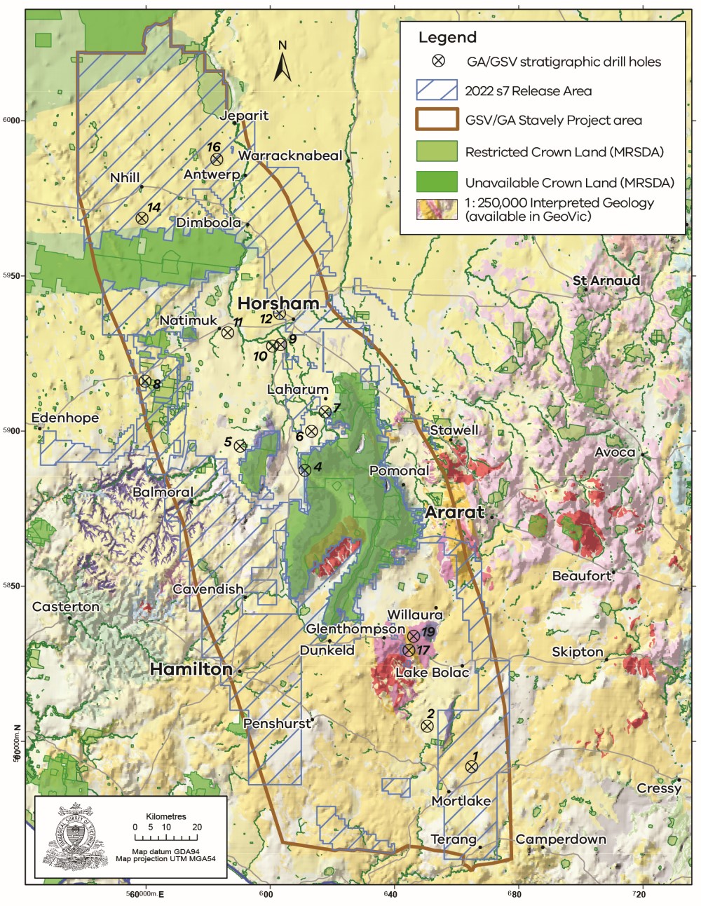
The Geological Survey of Victoria’s area of focus was the Stavely Project Area. Located within the known southern extent of the Stavely Arc, it comprises several belts of Cambrian volcanic rocks and related intrusions. Rocks of the Stavely Arc are exposed in just a few locations in the southeast and west of the project area. The majority of the Stavely Arc is concealed by a veneer of younger sedimentary and volcanic rocks.
Numerous known mineral occurrences are associated with exposed portions of the volcanic belts, several of which are currently under active exploration for copper and associated metals. The rocks of the Stavely Arc have been studied where these occur at the surface. However, the potential of many of the covered belts remains untested. This pre-competitive data and knowledge has identified the potential for mineral discoveries under cover.
Stavely Geoscience Project
The Stavely Geoscience Project sought to address the challenges of 'greenfield' minerals exploration in under-cover areas in Australia through the provision of pre-competitive fundamental geoscience data and concepts.
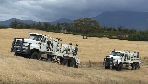
In partnership with the Deep Exploration Technologies Cooperative Research Centre DET CRC, 14 drill holes were completed for 2708.5 metres of stratigraphic rock layers to test regional geological interpretations. This enabled a better understanding of the depth and nature of cover and the recovery of rock samples for subsequent detailed analysis and research.
A combination of drilling methods was undertaken - sonic drilling to penetrate unconsolidated cover and diamond drilling through more competent rock. DET-CRC Lab-at-Rig™ technology was one of several techniques deployed during drilling.
The technical reports produced by the Stavely Project are listed below and are available through the GSV Catalogue. The report on the three-dimensional model of the regional geology can also be accessed.
The gathered evidence base formed the basis for the Stavely Ground Release investment attraction program in 2018. The simple mantra is that better pre-competitive data will attract more responsible explorers.
To learn more about the precompetitive data gathered, a number of Stavely presentations can be found on the Department of Jobs, Precincts and Regions YouTube channel.
You can also watch the documentary The Stavely Arc – uncovering the geological evolution of western Victoria. The documentary highlights the dynamic geological processes that occurred in western Victoria around 500 million years ago and how geoscientists delineated the Stavely Arc.
Page last updated: 01 Dec 2022