Native Title Public Notices
The Department is currently considering the following minerals licence applications.
Exploration Licences (EL)
If these licences are granted, the licensees will be permitted to explore for minerals on the specified land for the term of the licence, and to apply for two renewals of up to five years.
Becoming a native title party
Further information about becoming a native title party is available from the National Native Title Tribunal, Melbourne Registry, on 03 8638 6700 or by visiting the National Native Title Tribunal website.
For more information, contact Earth Resources Regulation.
These notices are given by the Department of Jobs, Precincts and Regions on behalf of the Minister for Resources in accordance with Section 29(3) of the Commonwealth Native Title Act 1993. The Department can be contacted at GPO Box 4509, Melbourne, VIC 3001.
Persons have until 22 June 2023 to take steps to become native title parties in relation to these licence applications. The notification date under Section 30 of the Native Title Act 1993 is 22 June 2023.
TENEMENT NUMBER: EL008010
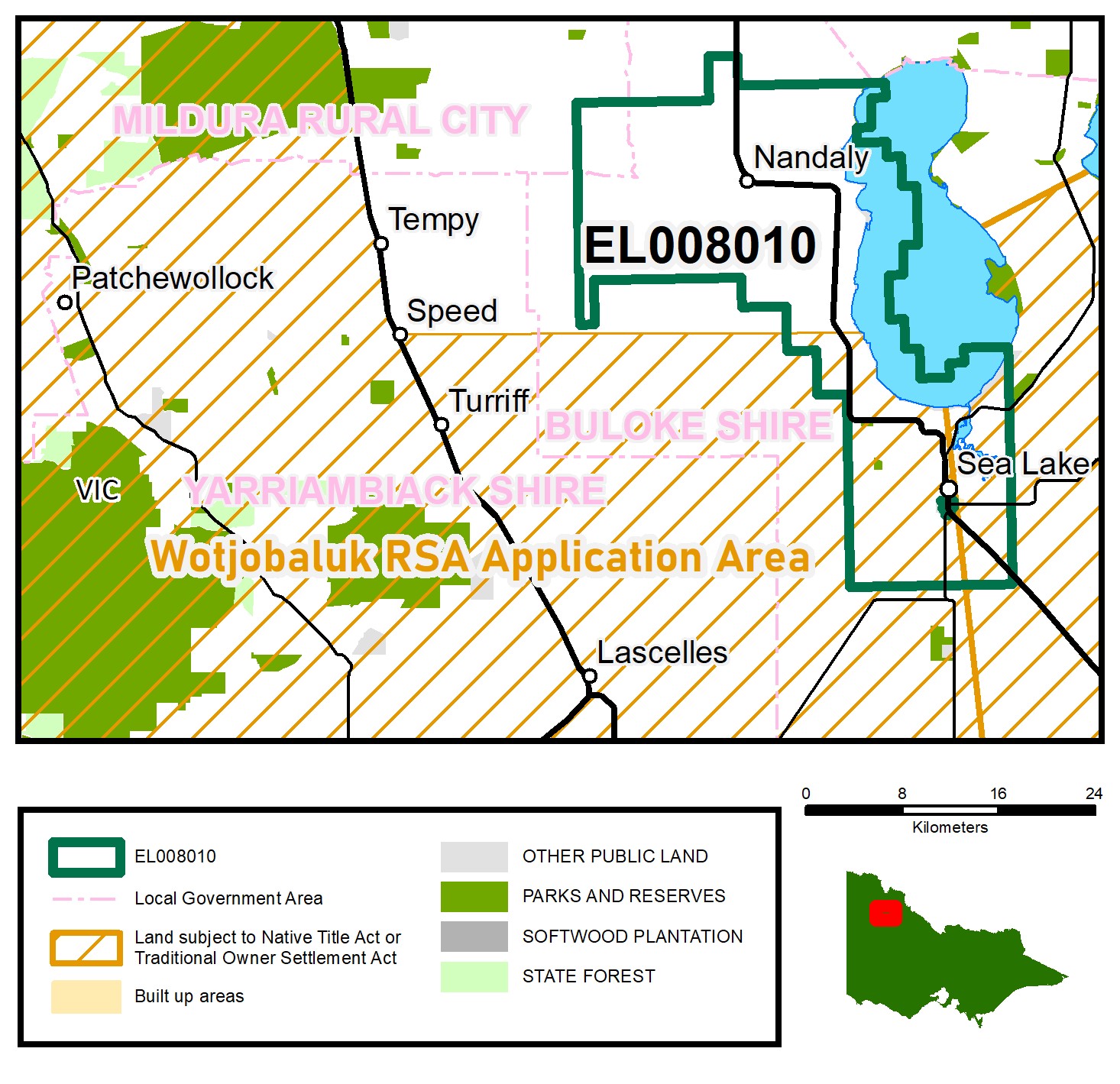 Centre MGA Co-ord 661225E 6079995N Z54 Centre 100k map 7427
APPLICANT: Yaapeet Gold Pty Ltd
LOCATION: 30.7 km south-east of Ouyen
NEAREST ROAD: Calder Highway
TERM: 5 years
AREA: 498.77 km2
MUNICIPALITY: Buloke, Mildura
TENEMENT NUMBER: EL008011
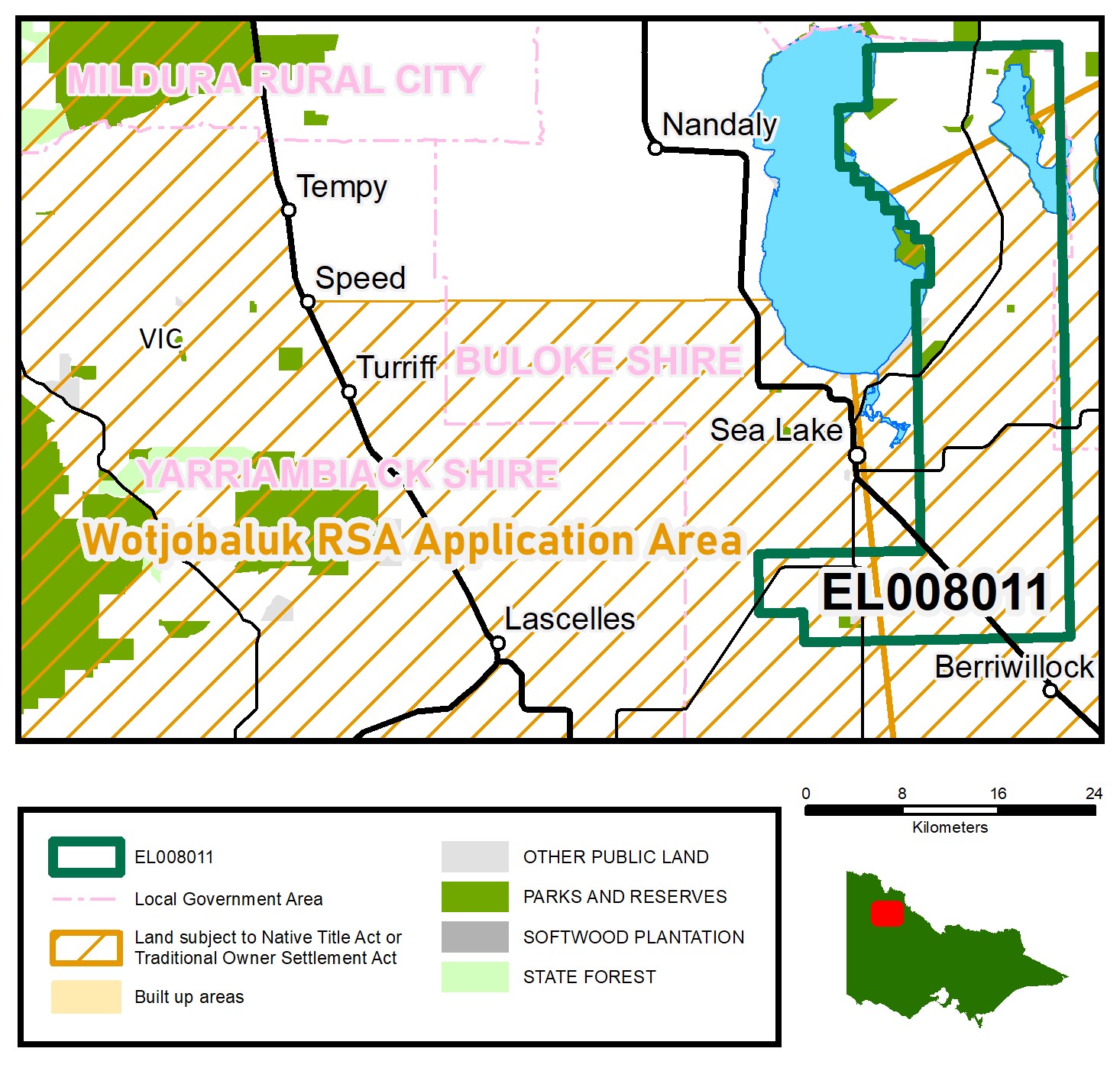 Centre MGA Co-ord 676221E 6078277N Z54 Centre 100k map 7427
APPLICANT: Yaapeet Gold Pty Ltd
LOCATION: 4.2 km east of Sea Lake
NEAREST ROAD: Sea Lake – Springfield Road
TERM: 5 years
AREA: 499.25 km2
MUNICIPALITY: Buloke
TENEMENT NUMBER: EL008012
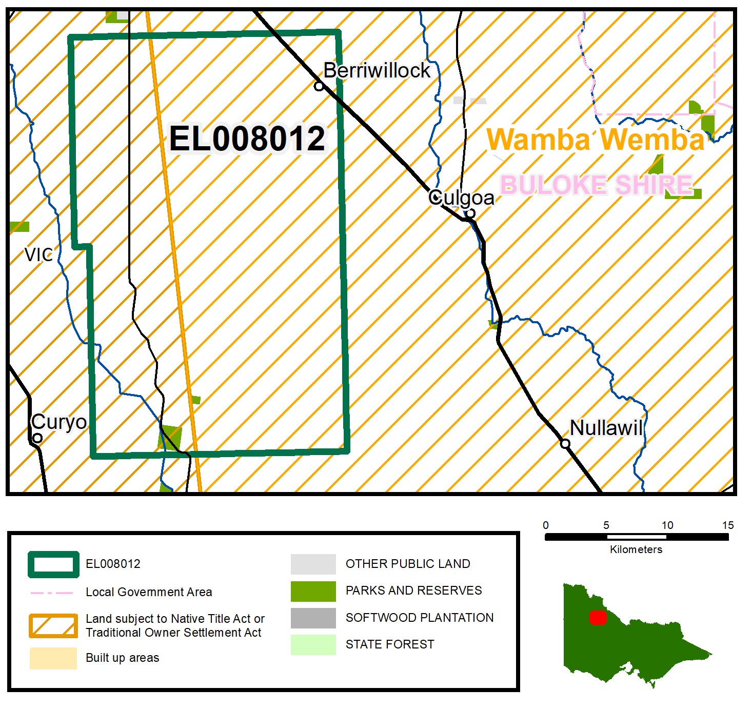 Centre MGA Co-ord 672948E 6044029N Z54 Centre 100k map 7426
APPLICANT: Hopetoun Gold Pty Ltd
LOCATION: 13.5km north of Birchip
NEAREST ROADS: Watchupga – Culgoa Road, Calder Highway
TERM: 5 years
AREA: 490.1 km2
MUNICIPALITY: Buloke
TENEMENT NUMBER: EL008013
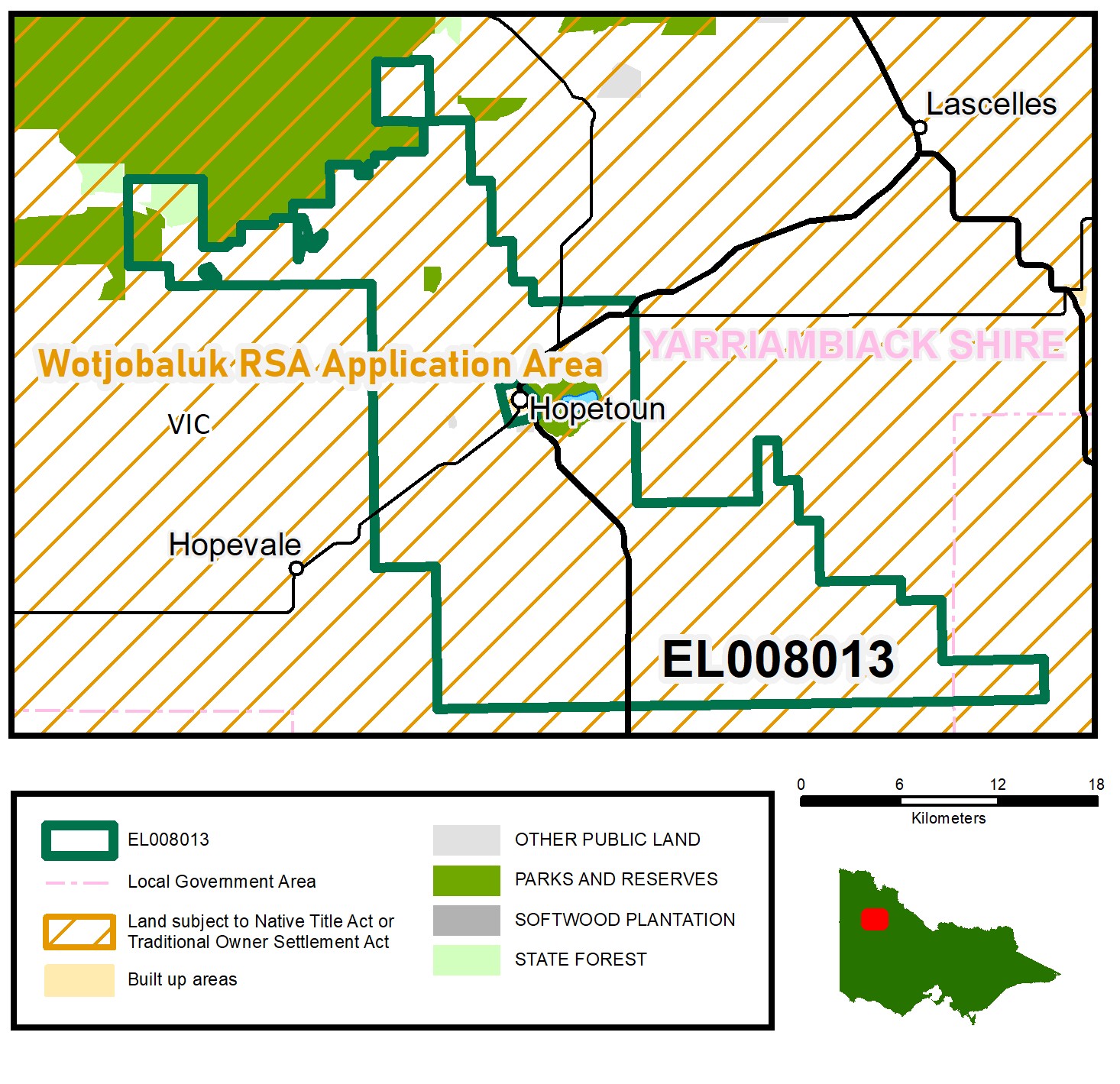 Centre MGA Co-ord 624622E 6041767N Z54 Centre 100k map 7326
APPLICANT: Hopetoun Gold Pty Ltd
LOCATION: 340 m east of the town centre of Hopetoun
NEAREST ROADS: Lascelles Street, Hopetoun – Yaapeet Road
TERM: 5 years
AREA: 478.76 km2
MUNICIPALITIES: Yarriambiack, Buloke
TENEMENT NUMBER: EL008034
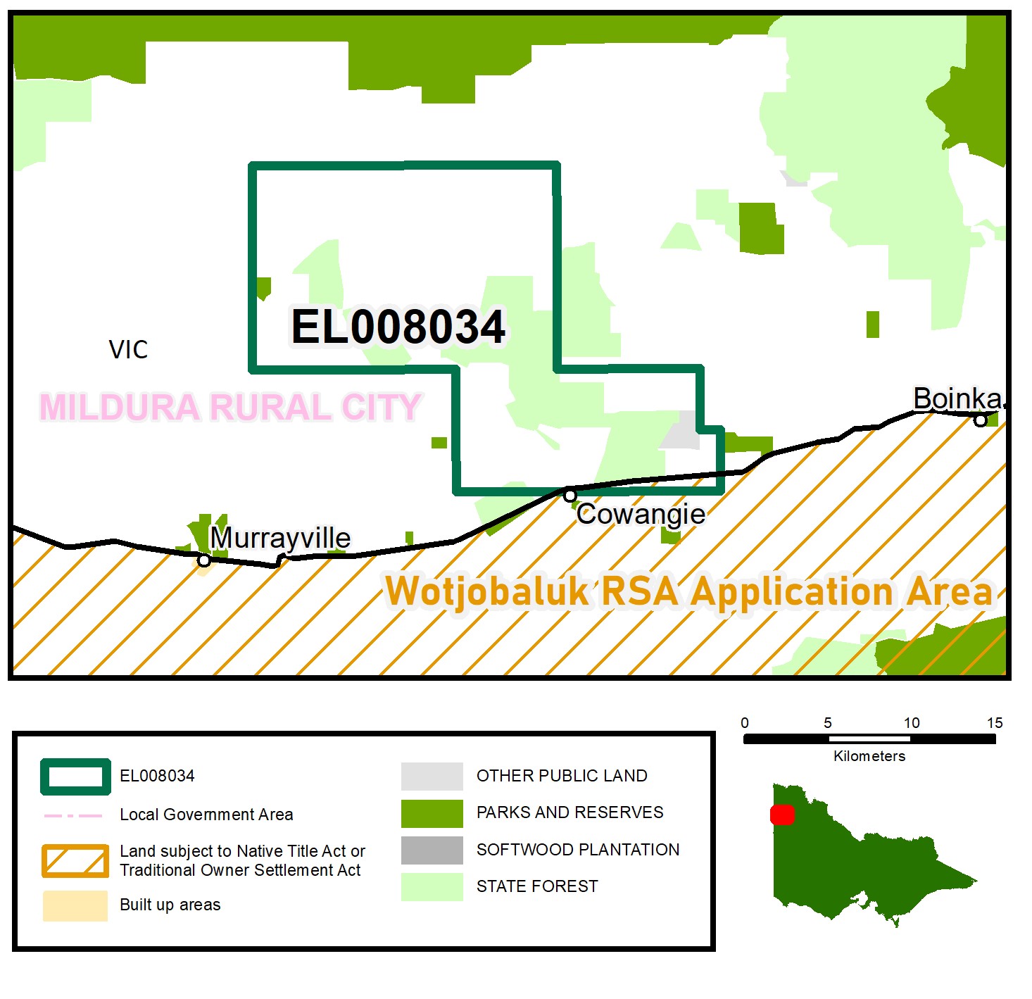 Centre MGA Co-ord 529223E 6108850N Z54 Centre 100k map 7127
APPLICANT: Paul Robert Lester
LOCATION: 180 m north of Cowangie
NEAREST ROAD: Mallee Highway
TERM: 5 years
AREA: 225.34 km2
MUNICIPALITY: Mildura
TENEMENT NUMBER: EL008035
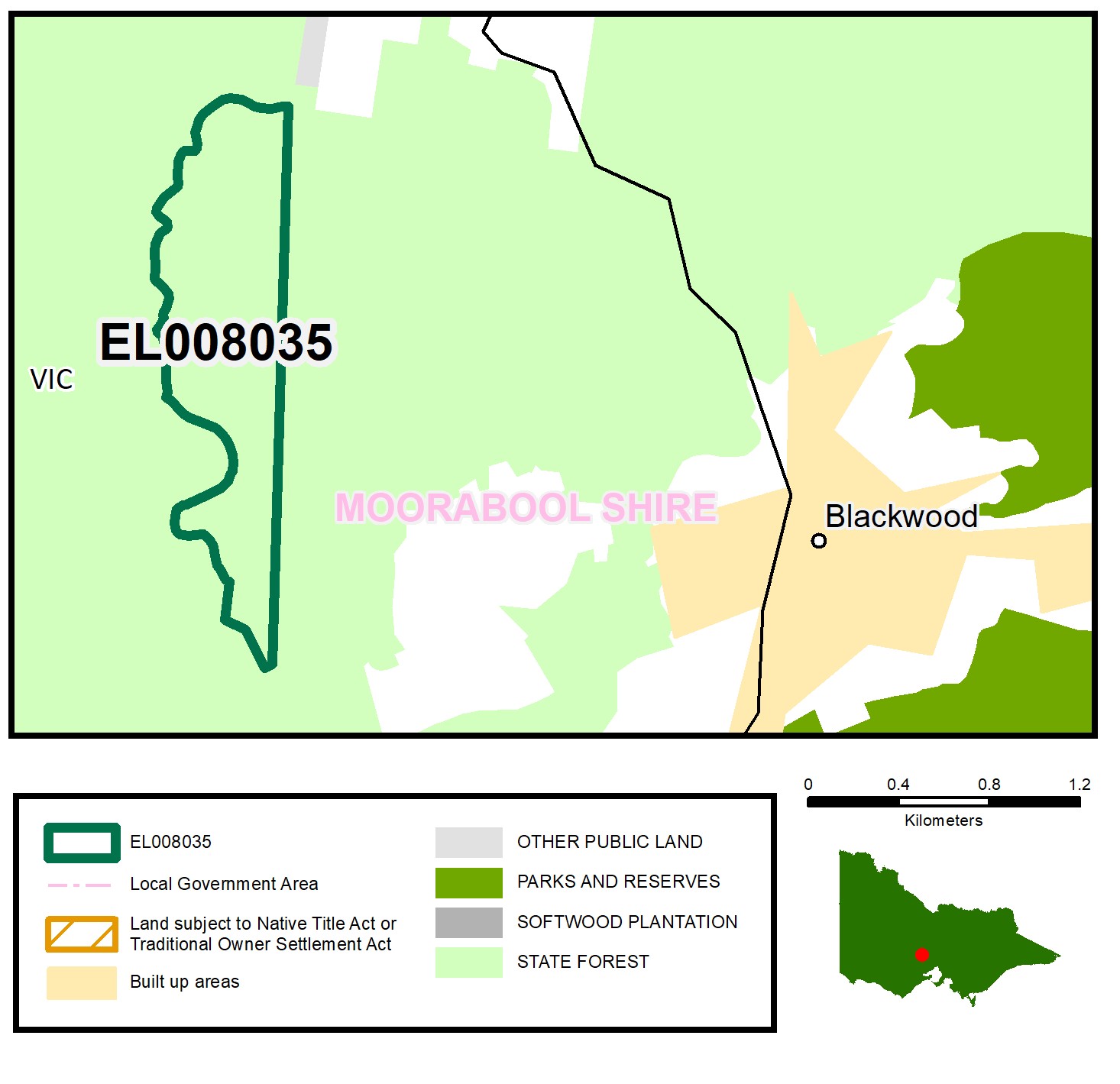 Centre MGA Co-ord 259767E 5849786N Z55 Centre 100k map 7723
APPLICANT: Currawong Resources Pty
LOCATION: 1.7 km west of Blackwood
NEAREST ROADS: Lerderderg Road, Newsultan Road
TERM: 5 years
AREA: 0.61 km2
MUNICIPALITY: Moorabool
TENEMENT NUMBER: EL008049
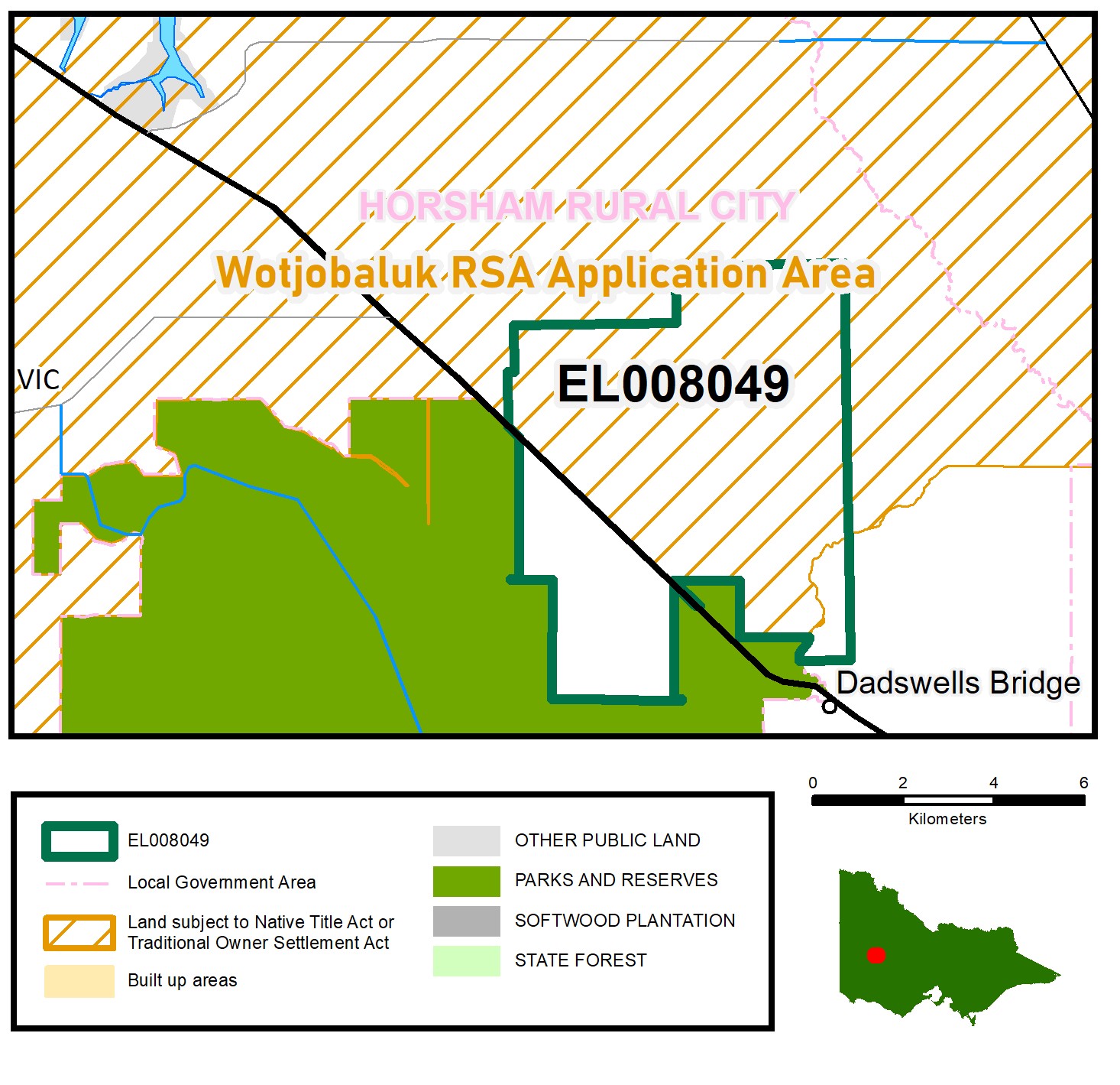 Centre MGA Co-ord 631793E 5917386N Z54 Centre 100k map 7324
APPLICANT: Rovatec Resources Pty Ltd
LOCATION: 27 km south-east of Horsham
NEAREST ROADS: Western Highway, Crutes South Road
TERM: 5 years
AREA: 36.65 km2
MUNICIPALITY: Horsham
TENEMENT NUMBER: EL008052
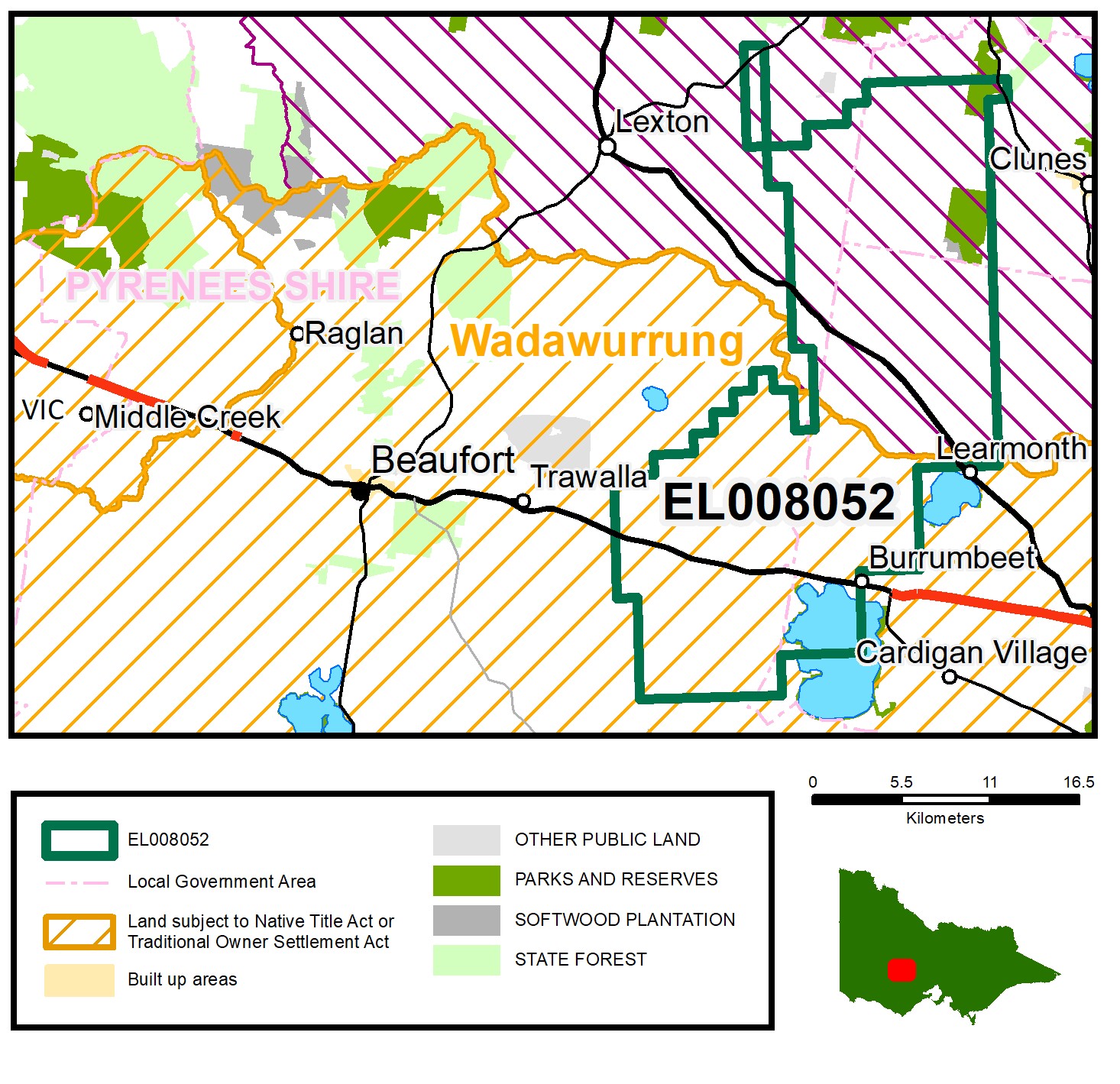 Centre MGA Co-ord 735226E 5857710N Z54 Centre 100k map 7623
APPLICANT: Outback Goldfields Australia Pty Ltd
LOCATION: 12 km east of Beaufort
NEAREST ROADS: Sunraysia Highway, Western Highway
TERM: 5 years
AREA: 339.73 km2
MUNICIPALITY: Swan Hill, Mildura
TENEMENT NUMBER: EL008107
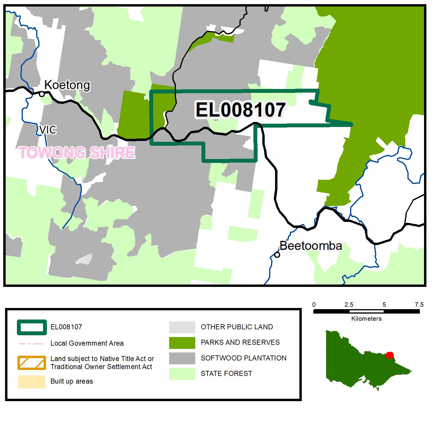 Centre MGA Co-ord 555400E 5997560N Z55 Centre 100k map 8425
APPLICANT: Jamieson Minerals Pty Ltd
LOCATION: 19 km north-west of Corryong
NEAREST ROAD: Murray Valley Highway
TERM: 5 years
AREA: 29.07 km2
MUNICIPALITY: Towong
TENEMENT NUMBER: EL008108
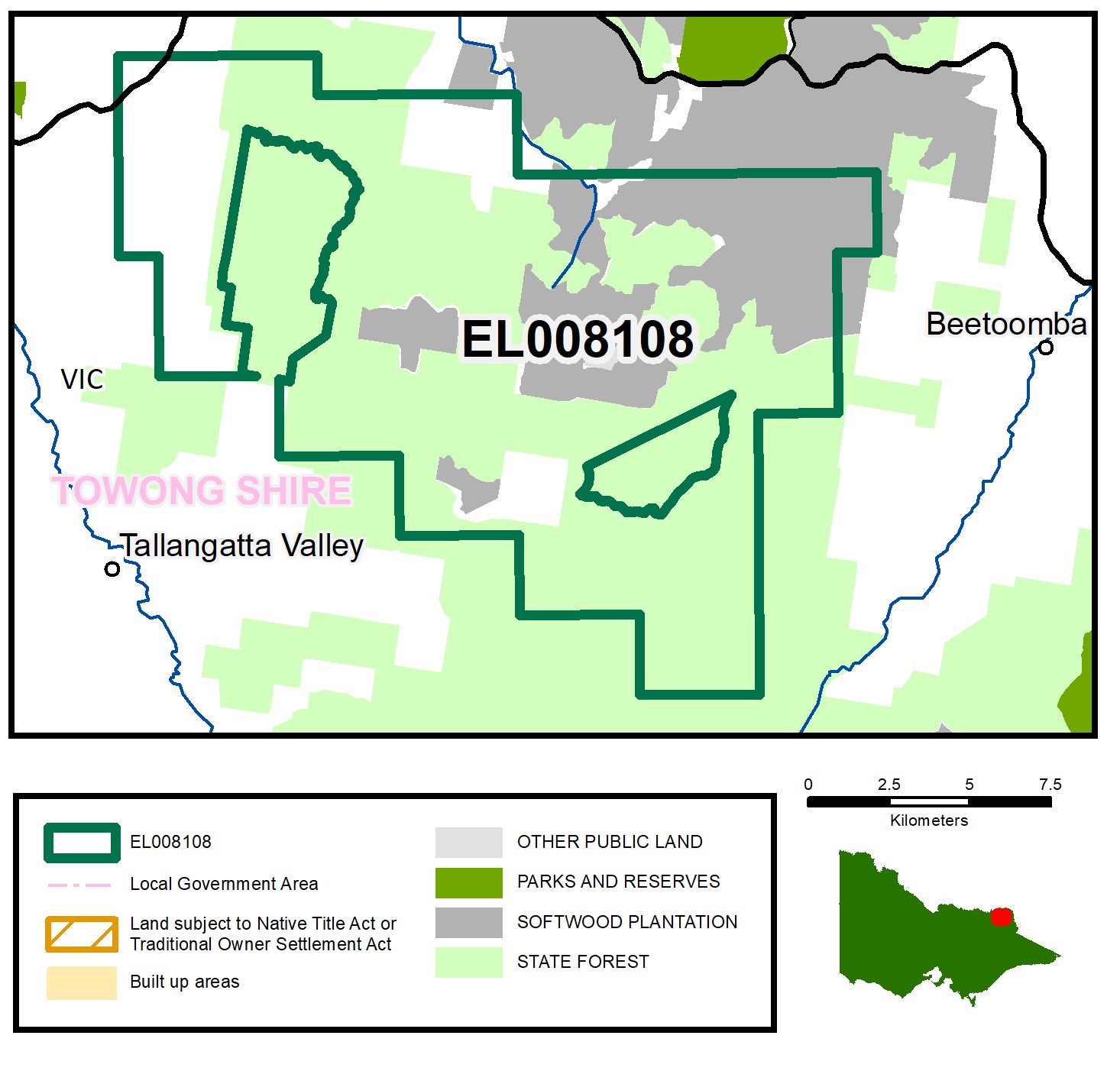 Centre MGA Co-ord 544165E 5990310N Z55 Centre 100k map 8425
APPLICANT: Jamieson Minerals Pty Ltd
LOCATION: 28 km west of Corryong
NEAREST ROAD: Murray Valley Highway
TERM: 5 years
AREA: 156.95 km2
MUNICIPALITIES: Towong
TENEMENT NUMBER: EL008109
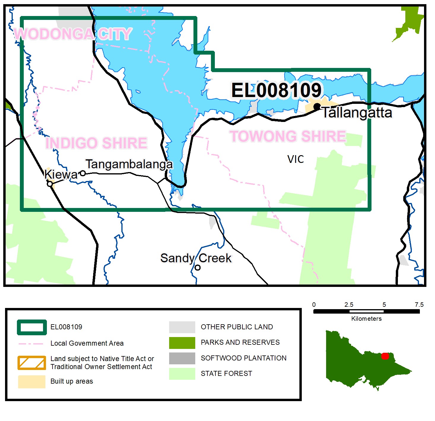 Centre MGA Co-ord 507746E 5991262N Z55 Centre 100k map 8325
APPLICANT: Jamieson Minerals Pty Ltd
LOCATION: 9.2 km south-east of Wodonga
NEAREST ROADS: Kiewa Valley Highway, Murray Valley Highway
TERM: 5 years
AREA: 191.07km2
MUNICIPALITY: Towong, Indigo, Wodonga
TENEMENT NUMBER: EL008110
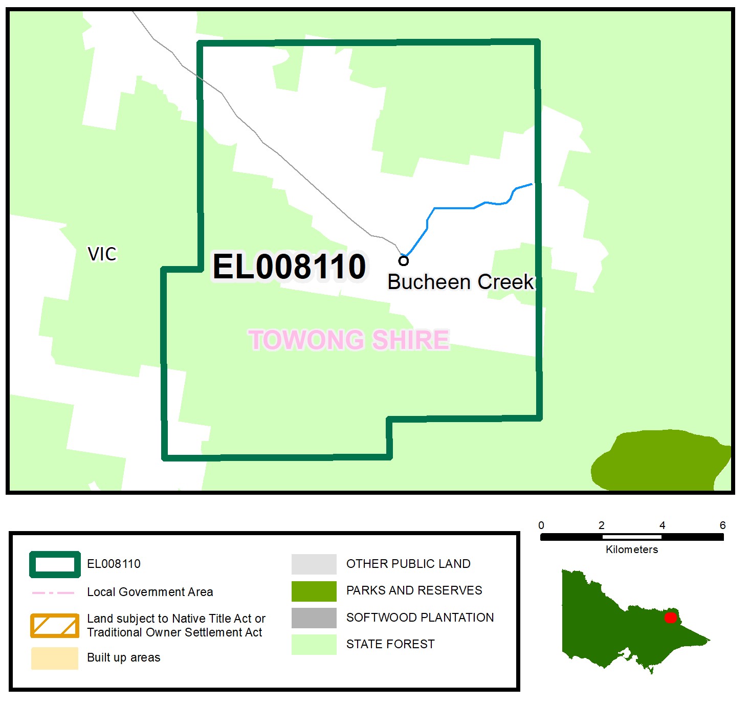 Centre MGA Co-ord 545689E 5969841N Z55 Centre 100k map 8425
APPLICANT: Jamieson Minerals Pty Ltd
LOCATION: 30 km south-east of Tallangatta
NEAREST ROADS: Tallangatta Creek Road, Greenham Road
TERM: 5 years
AREA: 100.05 km2
MUNICIPALITY: Yarriambiack, Buloke
Page last updated: 27 Sep 2023