Victoria's geology
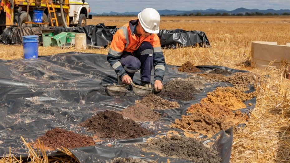
Victoria has a rich supply of earth resources including gold, oil and gas, mineral sands, base metals and brown coal. Our economic and social growth rely heavily on making the most of plentiful earth resources.
Victoria's geological history dates back to one billion years ago.
It can be divided into three major episodes:
- Neoproterozoic to Early Carboniferous
- Late Carboniferous to Mid-Mesozoic
- Mid-Mesozoic to the present day.
These episodes have been broken down below.
This period is covered by the Geological Survey of Victoria publication The Tasman Fold Belt System in Victoria.
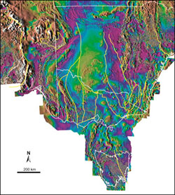 The sequence of events associated with the building of southeastern Australia reveals that mineralisation and magmatic processes are intimately linked with the tectonic development of the region. The history is dominated by east–west compression of predominantly oceanic sedimentary and volcanic rocks and their resultant folding, faulting and uplift. Recently, it has become increasingly apparent that major north–south movements have also been involved in constructing eastern Australia.
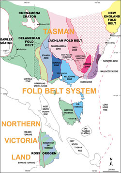
The Palaeozoic basement is traversed by thrust faults more or less parallel to the north–south structural grain. The largest faults separate rocks with different ages and structural histories, and subdivide Victoria into three main structural rankings consisting of:
- two fold belts (Delamerian and Lachlan)
- two terranes in the Lachlan Fold Belt (Whitelaw and Benambra)
- and ten structural zones (Glenelg, Grampians–Stavely, Stawell, Bendigo, Melbourne, Tabberabbera, Omeo, Deddick, Kuark, Mallacoota).
The Moyston Fault is the most important fault as it forms the terrane boundary between the Delamerian and Lachlan fold belts. These two fold belts show important differences. The Delamerian Fold Belt is mainly composed of Neoproterozoic–Cambrian rocks and was deformed in the Late Cambrian Delamerian Orogeny whereas the Lachlan Fold Belt contains mainly Cambrian–Devonian rocks with main deformations occurring in the Late Ordovician–Early Carboniferous interval.
 The first regional deformation to affect the Lachlan Fold Belt was the Benambran Orogeny, about 50 million years after the Delamerian Orogeny. Granites comprise 20 per cent of the total exposed area of the Lachlan Fold Belt and fall within an age range of 440 to 350 million years.
Volcanics associated with the granites are also widespread and cover an additional 5 per cent. Blocks of older crust consisting of Neoproterozoic–Cambrian rocks, such as the Selwyn Block in central Victoria, were deformed during the Late Cambrian Tyennan Orogeny prior to being incorporated into the Lachlan Fold Belt.
The second major structural break in Victoria is the Baragwanath Transform, which occurs along the eastern side of the Selwyn Block. This transform fault divides the Lachlan Fold Belt into two terranes:
- the Whitelaw Terrane to the west
- and the Benambra Terrane to the east.
The main difference between these is that orogen-parallel (north–south) transport was more prevalent in the Benambra Terrane, whereas convergent east–west transport orthogonal to the orogen was dominant in the Whitelaw Terrane.
Neoproterozoic and Cambrian rocks and the Delamerian and Tyennan Orogenies (520-490 million years)
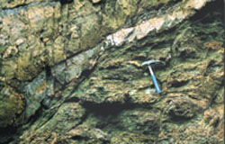 The oldest rocks of mainland southeastern Australia are Late Proterozoic or Cambrian volcanics, volcaniclastics and turbidites. Only the igneous rocks are exposed, in isolated belts at Waratah Bay, Philip Island and the Barrabool Hills and in a series of structural windows in the east of the Melbourne Zone.
The volcanics, along with the Delamerian Fold Belt rocks of the Glenelg and Grampians–Stavely zones, have been affected by an early deformation that is not present in any of the Lachlan Fold Belt rocks.
Images of total magnetic intensity data clearly show that these are northern extensions of the Tasmanian Neoproterozoic crust. The structural windows in the Melbourne Zone imply that this older crust occurs extensively below the Palaeozoic rocks.
The Glenelg Zone extends from an undefined margin west of the South Australian border, east to the Yarramyljup Fault. It contains Cambrian volcanics with ultramafic and within-plate basalt and mid-oceanic-ridge basalt (MORB) associations, and turbidites of the Moralana Supergroup. The Grampians–Stavely Zone extends east from the Yarramyljup Fault to the Moyston Fault.
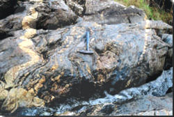 It consists of the largely buried Cambrian tholeiite–boninite rocks, and poorly outcropping Cambrian calc-alkaline volcanics and Glenthompson Sandstone. Both zones represent a poorly understood collage of volcanic and sedimentary rocks accreted to the older craton as a series of NW-trending fault-bounded strips.
Folding, faulting and regional metamorphism of the rocks of the Glenelg and Grampians–Stavely zones and the Selwyn Block occurred in the Cambrian. Although probably the same event, this is termed the Delamerian Orogeny in mainland Australia and the Tyennan Orogeny in Tasmania (and its northern extension into central Victoria).
East of the Moyston Fault, Cambrian volcanics not affected by Cambrian deformation are exposed in the Stawell, Bendigo and Tabberabbera zones along the largest faults. These faults penetrate to an inferred major mid-crustal décollement lying within the Cambrian volcanics.
The rocks are mainly tholeiitic basalts and less commonly boninites and ultramafics that are interpreted to be the basement to much of the Lachlan Fold Belt. Cambrian sedimentary rocks form the bulk of the exposure in the Stawell Zone, where they consist of thick turbidites (St Arnaud Group). Farther east, however, they overlie the Cambrian volcanics in long narrow belts and are a relatively condensed sequence of mudstone and chert.
Ordovician Sedimentation (490-440 million years)
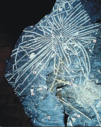 During the Late Cambrian and Ordovician, the Cambrian tholeiitic volcanics were covered by an extensive sheet of quartz-mica turbidites deposited into a deep marine environment along the eastern edge of the Australian craton. In the central west, the St Arnaud and Castlemaine groups comprise the bulk of these rocks in the Stawell and Bendigo zones respectively.
Quartz-mica turbidites also dominate the Lower and Middle Ordovician Adaminaby Group which extends over much of the eastern Lachlan Fold Belt.The only area with restricted Lower and Middle Ordovician sedimentation was in the Melbourne Zone, especially in the east where sediments are extremely condensed and include hale, sedimentary phosphate and, on the Waratah Bay Platform, a marginal marine marlstone. The Waratah Bay Platform contains no record of sedimentation between earliest Ordovician and mid-Early Devonian time.
Upper Ordovician sedimentary rocks show a very clear eastward-fining trend with the turbiditic Sunbury Group conformably overlying the very similar Castlemaine group now restricted to a relatively small area straddling the Bendigo and Melbourne zones. Farther east in central Victoria, and across much of the eastern Lachlan Fold Belt, the relatively condensed Bendoc Group (and Mount Easton Shale) dominated by siltstone and black shale accumulated on a deep anoxic seafloor.
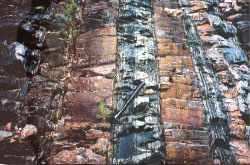 Contribution of volcanic turbidites from the Molong Volcanic Arc farther north was limited to the Kiandra Group, which outcrops in a small area in eastern Victoria.
Early Silurian (440-~425 million years)
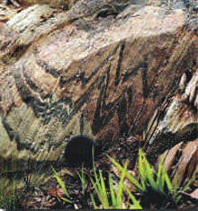 The interval beginning in the Early Silurian and lasting to the end of the Early Devonian was one of great complexity in the Lachlan Fold Belt. Much of the protracted Benambran Orogeny occurred early in the Silurian, and in the Benambra Terrane it was a period of extension and basin formation alternating with strong deformation during the Bindian and Tabberabberan orogenies.
In strong contrast with the regions both to the west and east, the Melbourne Zone remained unaffected by the Benambran and Bindian orogenies, a factor which is very important in reconstructing the Palaeozoic history of the Lachlan Fold Belt.
In the Grampians–Stavely Zone, the Grampians Group platform sequence was deposited on low-relief Delamerian crust. In eastern Victoria, the Ordovician–Silurian boundary coincides with widespread facies changes from euxinic Bendoc Group, dominated by black shale, to the sandier Cobbannah and Yalmy groups deposited in aerated sea-water. The eastern Victorian units were deformed at the end of the Early Silurian and underlie the widespread Benambran Orogeny unconformity.
During the Benambran Orogeny three metamorphic complexes were generated in Victoria:
- the Moornambool Metamorphic Complex in the Stawell Zone;
- the Omeo Metamorphic Complex in the Omeo and Deddick zones; and
- the Kuark Metamorphic Complex in the Kuark Zone.
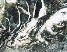 Shortening across the Stawell and Bendigo zones during the Benambran Orogeny was accommodated by closely spaced tight meridional folds with near-vertical axial planes, and by high-angle thrusts spaced at regular intervals, with a consistent west-over-east displacement. Despite the tight folding, the overall enveloping surface is gently dipping so that there is only minor variation in the metamorphic grade and the stratigraphic levels exposed.
In the Bendigo Zone, the rocks range from zeolite to lower greenschist facies, and through most of the Stawell Zone the outcrop is typically lower greenschist facies. Metamorphic grade is much higher in the western 15 metres of the Stawell Zone, rising to amphibolite facies in the hanging wall of the Moyston Fault, where there are abundant interleaved fault slices of mafic rock.
In the Melbourne Zone, marine deposition continued without interruption from the Cambrian to the Early Devonian, in the latter stages as a foreland basin. In eastern Victoria, tectonism in the Benambran Orogeny began in the Late Ordovician in the Narooma Accretionary Complex and was more strongly expressed by a regional facies change, uplift and local deformation, at about the Ordovician-Silurian boundary at 440 million years.
During continuing deformation Llandovery rocks were folded and faulted together with Ordovician rocks at about 430 million years (end of the Llandovery) and the Omeo Metamorphic Complex was generated. It was followed by the intrusion of I and S type granites with ages of about 425 to 420 million years.
Late Silurian (425-420 million years)
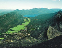 In the Late Silurian, deformation of the Grampians Group to form a thrust-and-fold belt commenced, and, together with widespread reactivation of western Lachlan Fold Belt faults, may represent the culmination of the effects of the Benambran Orogeny in western Victoria.
The evolution of eastern Victoria at this time is quite different to western Victoria, and must be seen in the context of prolonged horizontal displacement of eastern Victoria, travelling south with respect to the Gondwana landmass. During and following the Benambran Orogeny, large-scale faults subdivided eastern Victoria into a series of dislocated blocks (structural zones and subzones) that show a prolonged history of differential horizontal displacement during the remainder of Silurian and Early Devonian time.
Crustal extension and horizontal displacement in the Late Silurian produced the Cowombat Rift, consisting of the Limestone Creek and Wombat Creek graben. These grabens contain mainly shallow marine rhyolitic lava and high-level intrusions overlain by marine to subaerial volcaniclastic siltstone, sandstone and conglomerate below fine-grained turbidites with stratiform lenses of altered andesitic lava and limestone.
In the Melbourne Zone, shallow to deep marine sedimentation (Yarra Supergroup) continued without interruption through the Silurian and Early Devonian.
Early Devonian Bindian Orogeny (420-~410 million years)
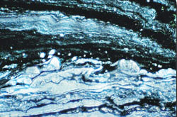 At the end of the Silurian, rocks in the Cowombat Rift were faulted and tightly to isoclinally folded parallel to the rift margins, presumably controlled by the rigid rocks on the rift flanks. The volcanics were metamorphosed to lower greenschist facies and often were strongly cleaved. Newfabrics overprinted Benambran fabrics in the Omeo Metamorphic Complex. The most significant structures formed during the Bindian Orogeny include the Kiewa,Kancoona, Ensay and Indi faults.
The deformation occurred in a regime of mainly strike-slip movement. Several hundred kilometres of displacement between the Benambra and Whitelaw terranes was taken up by inferred dextral strike-slip displacement along the Baragwanath Transform. Elsewhere in the western and central parts of the Benambra Terrane, the effects of the Bindian Orogeny were concentrated along smaller strike-slip and thrust faults that accommodated the internal fragmentation of the Benambra Terrane as it moved southward.
No effects of the Bindian Orogeny are recorded in the Whitelaw Terrane of central and western Victoria.
Early Devonian rifting, volcanism and sedimentation (410-385 million years)
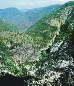 The Bindian Orogeny was followed by a second period of crustal extension that affected much of the eastern Lachlan Fold Belt. Bimodal (but dominantly felsic) volcanism occurred at several scales: in large rift-like basins where the volcanics are overlain by limestone, and in much smaller cauldrons.
The largest rift-like basins in eastern Victoria are the Buchan Rift and the Mitchell Basin, with smaller basins at Errinundra (the Boulder “graben”) and Bindi (the Bindi Syncline). The thick but poorly dated Mount Tambo Group may also have been deposited at this time. Cauldrons formed at this time include the Mount Burrowa, Dartella, Besford, Mount Elizabeth and Mount Gelantipy.
In the Buchan Rift there were two stages of rifting producing a mixture of volcanics and minor non-volcanic sediments (Snowy River Volcanics). Prolonged erosion was followed by a final phase of silicic to mafic olcanism and lacustrine sedimentation. Most of the sequence is subaerial, but in the southern half rifting and subsidence outstripped deposition, giving an important interval of submarine turbidites and dark shale. Pyroclastics, especially ignimbrites, make up much of the sequence but most are relatively thin. Sedolithic conglomerate and sandstone occurs at many levels, showing that the rift was a persistent topographic low and that rifting continued through the entire basin history.
In the Melbourne Zone, sedimentation continued without break (Yarra Supergroup). Along its western margin, shoreline facies are present. These may be coeval with rare conglomerates preserved in the eastern Bendigo Zone. To the east, the sediments were mostly deep marine except on the Waratah Bay Platform on which very shallow marine limestone accumulated. Not until late in the Early Devonian is there any evidence of sediment supply from the cratons of eastern Victoria. This suggests that either there was a major barrier to the sediment coming west or the cratons were not in their present position with respect to the Melbourne Zone.
In western Victoria, numerous granites, mostly I-types, were intruded. On the Delamerian craton, A-type volcanics (Rocklands Volcanics) were deposited over the already deformed and eroded Grampians Group.
Middle Devonian Tabberabberan Orogeny (385-380 million years)
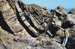 The Tabberabberan Orogeny was the first deformation that affected all parts of the Lachlan Fold Belt in Victoria. The orogeny marks the amalgamation of the Whitelaw and Benambra terranes and cessation of dextral strike-slip movement along the Baragwanath Transform. Its effects were most strongly felt in previously undeformed regions with thick sediment fills such as the Melbourne Zone, Mitchell Syncline, Boulder “graben” and Scrubby Creek Syncline. Deformation was also intense along the Governor Fault, the northern and eastern bounding structure to the Melbourne Zone. Within the Melbourne Zone, sedimentation ceased and the rocks were folded, generally into much more open patterns than the adjacent Bendigo and Tabberabbera zone rocks.
In the areas already substantially cratonised in the Benambran and Bindian orogenies, the Tabberabberan Orogeny mostly produced isolated brittle structures that had little effect on the overall structural framework.The Tabberabbera Zone is probably the only exception to this. More ductile structures, such as minor folds and cleavage, affected the previously deformed bedrock in the south of the zone and strong faulting occurred along its western margin during amalgamation with the Melbourne Zone. In the Kuark and Mallacoota zones the effects of deformation are poorly dated and it is possible that some ductile deformation occurred. Many older faults were reactivated, including the Kiewa, Kancoona, Indi and Ensay faults and the bounding faults to the Buchan Rift.
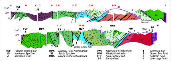
By the end of the Tabberabberan Orogeny, all of Victoria had been cratonised and the various crustal blocks were in more or less their present-day positions with respect to each other.
Late Devonian volcanism, plutonism and sedimentation (380-350 million years)
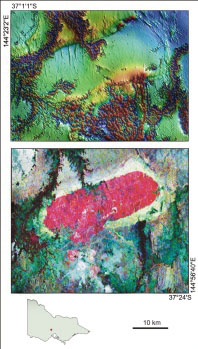 Volcanism and sedimentation began during the waning phases of the Tabberabberan Orogeny. Upper Devonian rocks are widespread in central Victoria and preserved in several large synclines farther east. The strong palaeogeographic differences that had existed in the various structural zones prior to the Tabberabberan Orogeny are no longer in evidence. They are thus relatively uniform across the fold belt and ignore structural zone boundaries.
However, two quite different provinces were formed. The Central Victorian Magmatic Province, which extends from the western edge of the Bendigo Zone across the Melbourne Zone into the westernmost Tabberabbera Zone, consists of granite plutons and silicic cauldron complexes.The Howitt Province, along the margin between the Melbourne and Tabberabbera Zones, contains a thick sequence of red-bed fluvial sediments and silicic volcanics and was originally connected with the East Gippsland Province where fluvial sediments predominate.
Early Carboniferous Kanimblan Orogeny (350-325 million years)
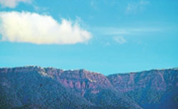 The Upper Devonian – Lower Carboniferous red-bed sequences were folded and faulted in the Carboniferous. Age control on this event is very poor within Victoria and the deformation is, by convention, correlated with the Kanimblan “Orogeny” in New South Wales where it is considered to have occurred sometime in the Early Carboniferous.
In Victoria the deformation was of somewhat different character in the two main outcrop belts, the Howitt and East Gippsland provinces. In the Howitt Province, Kanimblan structures have formed independently of the pre-existing structures and none of the Tabberabberan structures show Kanimblan offset, not even the Governor Fault.
The probable reason is that Kanimblan structures originated as extensional structures during Late Devonian basin formation and were not able to employ pre-existing compressional structures. By contrast in the East Gippsland Province, Kanimblan faults are rejuvenated earlier structures, suggesting that there were no Late Devonian extensional structures available.
Late Carboniferous to Early Permian (300-285? million years): Glaciation and marine sedimentation
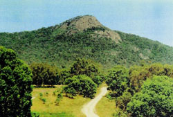 At this time the Australian portion of Gondwana lay near the South Pole and had a glacial climate. Glacial deposits are widespread across southern Victoria, especially at Bacchus Marsh and east of Bendigo. They consist of tillite, slump deposits and sandstone and siltstone (Wild Duck Formation and Boorhaman Conglomerate) deposited by glaciers and periglacial and sub-glacial streams, probably in a glaciomarine environment.
Striated pavements show that ice movement was mainly towards the north. Marine conglomerates occurring as far south as Bacchus Marsh suggest that a substantial part of the tillites may have been deposited in shallow marine conditions. The Urana Formation, occurring in the subsurface in north-central Victoria, is entirely marine, deposited in quiet, anoxic water.
Triassic (250-205 million years): Rivers and granites
Triassic rocks are of very limited distribution in Victoria. At Council Trench near Bacchus Marsh, a very thin cap of conglomerate, sandstone and mudstone with chopped-up plant fossils is a fluvial deposit. It overlies glaciomarine Permian sediments.
In the Benambra region in Eastern Victoria, the Mount Leinster Igneous Complex is scattered over an area of about 350 kilometres squared. It is a suite of alkaline igneous rocks consisting of trachyte, volcaniclastics, volcanogenic sediments, syenites and porphyritic granites.
The Teapot Creek Formation represents the remains of a once extensive sheet of volcanics which was deposited onto the Triassic land surface. This was subsequently intruded by a number of high level syenite and granite porphyry bodies. Apart from being within-plate intrusions, the tectonic setting of these rocks is poorly understood. Perhaps they herald the extension and subsequent breakup of Gondwana.
Late Jurassic to Cretaceous (ca. 150-65 Ma): Break-up of Gondwana
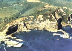 The Gippsland, Bass and Otway basins form part of the Southern Rift System, which formed as a result of rifting and continental breakup of the Australian and Antarctic continents. During the late Jurassic – Early Cretaceous (150–120 million years) early rift-fill lacustrine and fluvial sediments and minor volcanics (Casterton Formation and Crayfish Group) were deposited in a series of half-grabens formed in the Otway, and possibly Bass, basins as part of the Gondwana breakup.
Rifting and associated sag continued through to the end of the Albian (95 million years) resulting in a thick, volcaniclastic-rich sequence of nonmarine greywackes, mudstones and minor coals (Eumeralla Formation and Strzelecki Group). These fluvial successions are today exposed in several basement highs (Otway and Strzelecki ranges).
With the onset of sea-floor spreading between Australia and Antarctica during the Late Cretaceous Cenomanian, the terrestrial to marginal marine Sherbrook Group was deposited in the Otway Basin. This contrasts with the lacustrine rift-fill sediments of the Emperor and Golden Beach subgroups in the Gippsland Basin, associated with the development of the Tasman Sea rift during the Cenomanian to Early Campanian (95–80 million years). The Bass Basin persisted as a failed rift, with nonmarine sedimentation continuing until the Eocene (Eastern View Group).
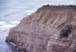 At the basin margins, subsidence was balanced by major uplift of the coastal hinterland represented by the Great Dividing Range in Victoria. The area to the north east of the range was not uplifted, but became the Murray Basin and was filled with mainly marine sediments (Millewa Group).
Palaeocene to Recent (65 million year - present day): Paralic sedimentation, stream incision and basaltic volcanism
The Late Cretaceous uplift began a cycle of incision and lateral erosion that continues to the present day. Sediments eroded from the highlands were transported onto the wide coastal plain as well as further offshore. The coastal plain environment of the Gippsland Basin included large swamps and marshes, parts of which were later converted into coal beds that are regarded as the main source rocks for the basin’s economic oil and gas accumulations.
In the Latrobe Valley, the geological and climatic conditions from the Eocene to the Miocene were favourable for the generation of extremely thick brown-coal measures (Latrobe Group). Marine clastic sedimentation continued in the Otway Basin (Wangerrip and Nirranda groups) until the Oligocene.
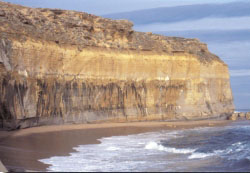 From the early Oligocene onwards, deposition of marine siliciclastic sediments ceased in the offshore and was followed firstly by the accumulation of fine-grained clay-rich, then by prominently fossiliferous cool-water carbonates. Nonmarine sedimentation prevailed in the Murray Basin, becoming marine in the Oligocene. Episodes of tectonism have repeatedly modified the sedimentary pile of the southern basins into a complex structural system, reflecting the rift architecture of Victoria’s basins.
Within the last two million years small scale volcanic eruptions (Newer Volcanics) have had a major impact on the Victorian landscape. About 400 volcanoes have produced extensive basalt flows forming a thin veneer (generally less than 50 metres) covering much of western Victoria. The basalt plains consist of superimposed valley flows and volcanic centres with associated basaltic aprons.
The Geological Survey of Victoria researches and maps Victoria’s geology, providing this information to investors and the public.
More information
Page last updated: 08 May 2023